GPS VerifiedSite Evidence
Capture GPS-tagged photo evidence for retrofit, compliance, funding and installation work.


GPS Verification
Capture location-verified evidence directly from site installations and inspections.
Compliance Workflows
Structured checklists and audit-ready evidence for government-funded schemes.
Offline Support
Continue working in low signal areas with automatic syncing when back online.
Built for Engineers in the Field
Designed for teams that need reliable, fast evidence capture in challenging environments.
Offline-First Design
Work anywhere, sync when you have connection. Perfect for remote sites.
Built-in GPS Tagging
Every photo automatically captures location data for compliance proof.
Professional Reports
Export evidence as branded reports ready for clients and regulators.
Powerful Back-Office Management
View all evidence in real-time, manage teams, track progress, and generate compliance reports instantly.
Learn More→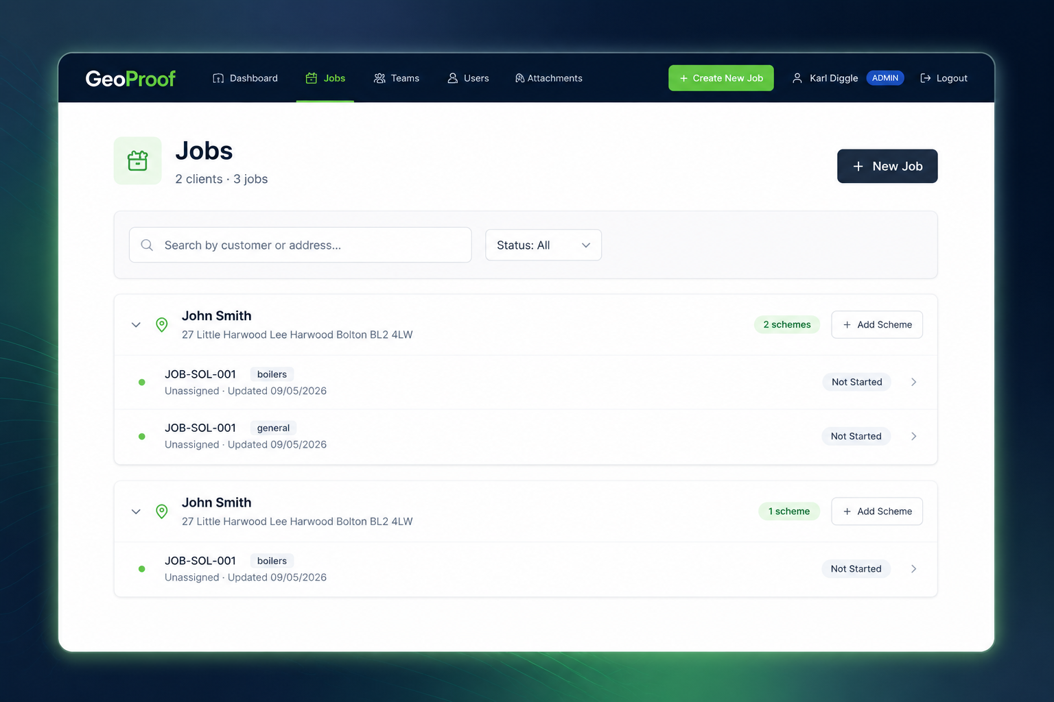
From Site to Submission in Minutes
Simple workflow that gets field teams moving faster.
Assign Jobs
Create and assign evidence capture jobs to field teams
Capture Evidence
Teams capture GPS-tagged photos on-site, offline-ready
Submit Packs
Submit complete evidence packs with one tap
Professional Evidence Packs in Seconds
Generate complete, audit-ready evidence packages with photos, metadata, and compliance reports.
Evidence Brief Pack
Quick summary with photos and key metadata
Detailed Site Datasheet
Complete information with GPS verification
Compliance Audit Log
Full evidence trail with timestamps
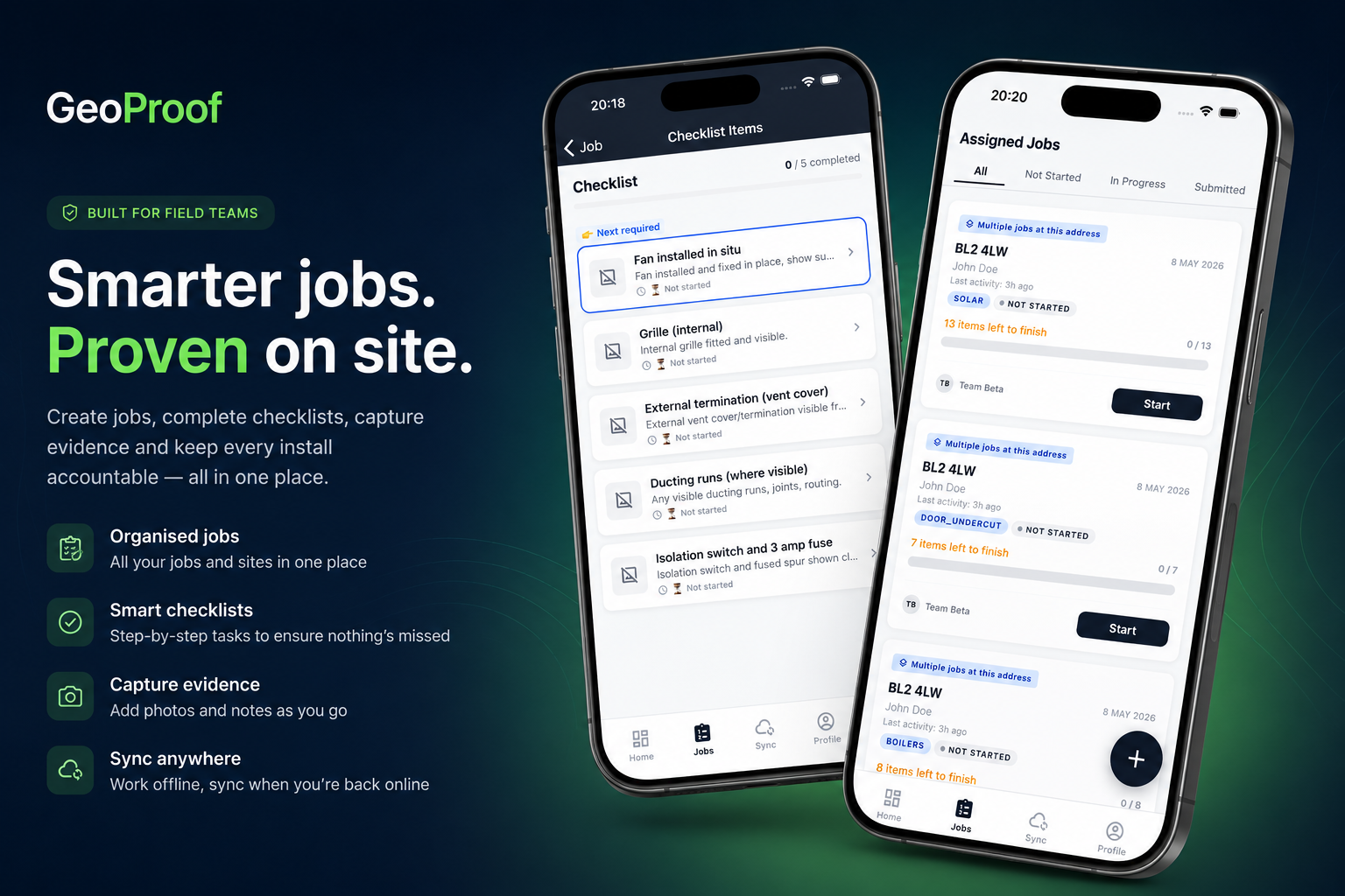
Run Your Jobs From Site,Not the Office
GeoProof gives field teams everything they need on iPhone and Android — capture evidence, complete checklists, and sync instantly when back online.
Used by field teams across retrofit, compliance, and funded installation projects.
Modernise Your Evidence Collection Workflow
Join thousands of engineers and contractors capturing better evidence faster.
Ready to Transform Your Evidence Collection?
See how GeoProof can streamline your workflows. Get a personalized demo from our team.
📅Book Your Free Demo TodayNo credit card required. Typically takes 15-20 minutes to see real results.